Tailings Management Software | Governance Solution | K2fly
Solution

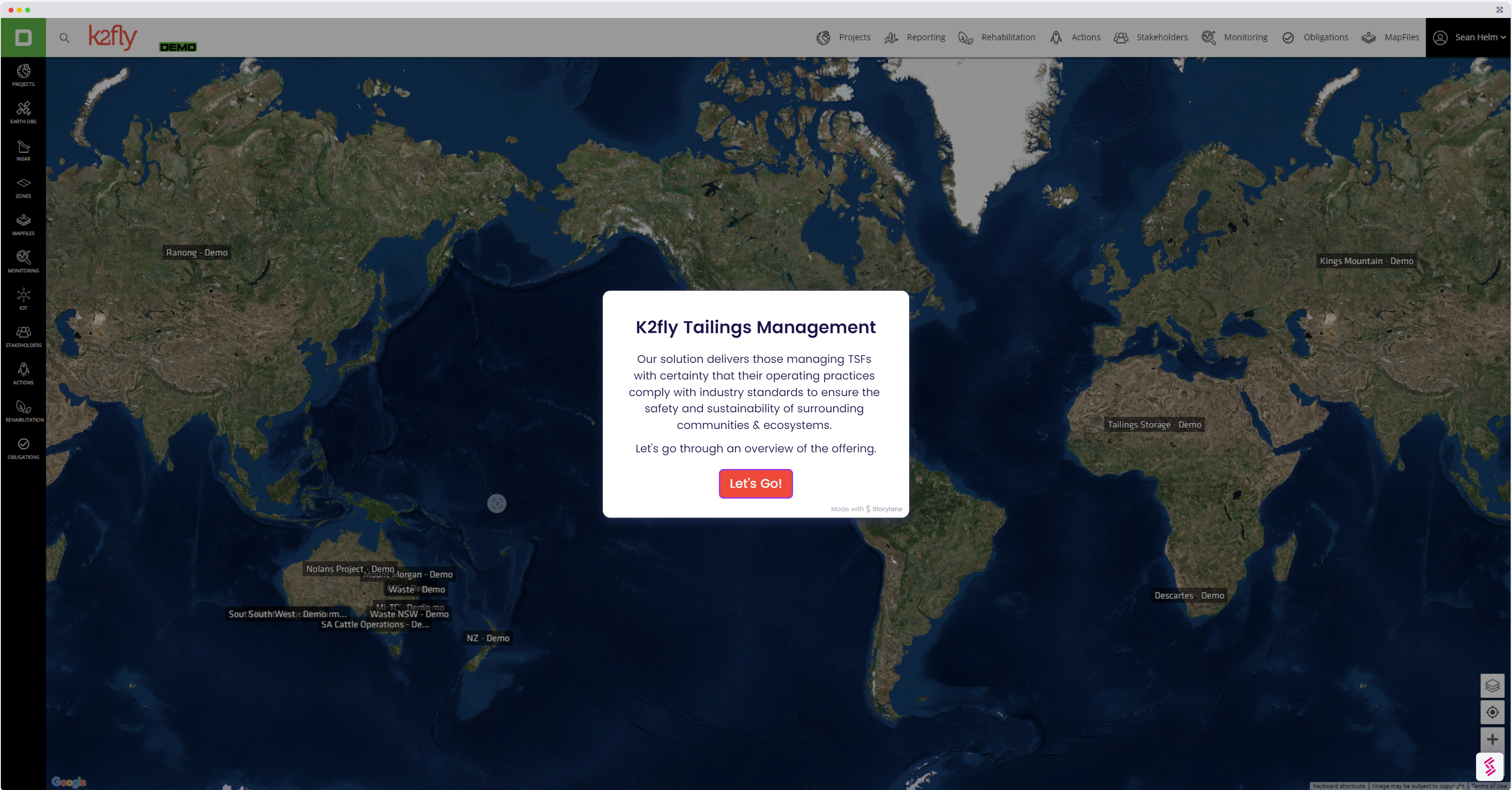
K2fly Tailings Management

An Integrated Compliance Solution

Improve compliance and provide visibility to reduce risks and manage your obligations with K2fly Tailings Management. Implement safety through our advanced platform and integrations.

Reduce Risk, Increase Safety

No other solution brings so many components of tailings and environmental monitoring and management together like K2fly. Align and comply with the Global Industry Standard on Tailings Management (GISTM).

One Central View
Centralise data from various sources into one location enabling you to safeguard potential failures.
Showcase your Compliance
Designed to adhere to industry best practice and compliance requirements such as ICMM, PRI, UNEP, ANCOLD, ICOLD and the GISTM
Disclose Data
Collect, manage and disclose tailings data in near real-time with confidence, governance and accuracy for requests from industry groups whilst significantly increasing efficiency and time savings.

Near real-time data

Working with the latest data and imagery

K2fly collects near real time earth observation data from a variety of sources including Satellite imagery (Landsat and Sentinel) so you can make informed decisions fast.

Tailings Management Feature Sets

InSAR

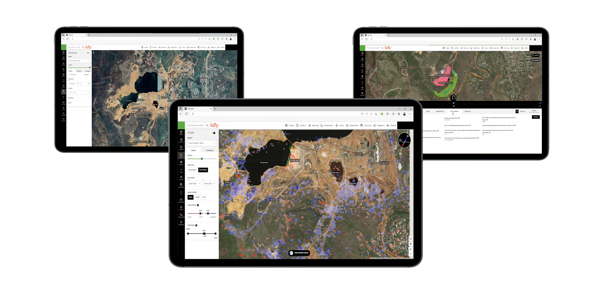
Monitor, measure and detect deformation of land surfaces and be automatically alerted to safety exceedances down to 1-2 cms.

IoT

Monitor unplanned structural movements of earth in near real-time and be automatically alerted to customer defined exceedances.

Earth Observations & Zones

Visualise and access advanced analysis and imagery including NDVI, NDRE, MSAVI and NDWI

Environmental Monitoring

Manage your project-specific data requirements and insights to help drive effective environmental monitoring

Stakeholders

Manage and plot external stakeholder profile information and any point of engagement between them or actions required

Obligations

Project specific legal obligations such as permits, approvals, licences and any actions associated with the conditions

Map Files

Visualise your geospatial data to identify trends and gain important insights

Features

Remote sensing

Monitor land subsidence and movement utilising remote sensing such as satellite derived InSAR datasets

Action tracking

Action and task delegation for data collection with reminder and escalation notifications

Alerts

View near real-time data and receive alerts related to TSF device data such as piezometers, monitoring bores, water levels and vibration

Spatial data

Effectively monitor your facilities with our spatial data such as InSAR, DEM and more

Compliance limits

Maintain and track environmental monitoring compliance limits and be alerted to any exceedances

Documentation

Upload and reference key documentation related to tailings, obligations, standards and more with audit history

Multiple sites

Visualise facilities across multiple sites in a single screen on a geospatial map

Monitoring data

Capture a wide range of monitoring data and indicators such as surface and groundwater, decant pond water levels and quality, and embankment conditions

Add a layer of governance to everything you do

Have confidence in your data accuracy and task completion knowing every step and appropriate sign-off has been followed

Extend your capability with our integrated solutions

Our solutions work with one another as well as third party platforms

All Solutions

The K2fly Platform

Regular updates
We are constantly adding new functionality to our solution which is passed on to your company to benefit
Cloud accessible
Securely access data from anywhere in the world, on nearly any device to reduce travel and in times like COVID
Third party integration
We integrate with your existing systems and APIs to eliminate business disruption and increase operational efficiency
Strong partnerships
We partner with industry leading organisations including SAP, ESRI and CrC-TIME to improve delivery and deliver best practice
Reporting friendly
Our solutions come built with reporting and dashboarding tools but also allow for third party reporting and data exports
User Management
Securely control access to employees, auditors and contractors so they can see the data and functionality they need
K2fly's solutions are trusted by the worlds biggest miners in over 54 countries
Fortescue
Newmont
Newcrest
Roy Hill