Solución
K2fly Land Rehabilitation
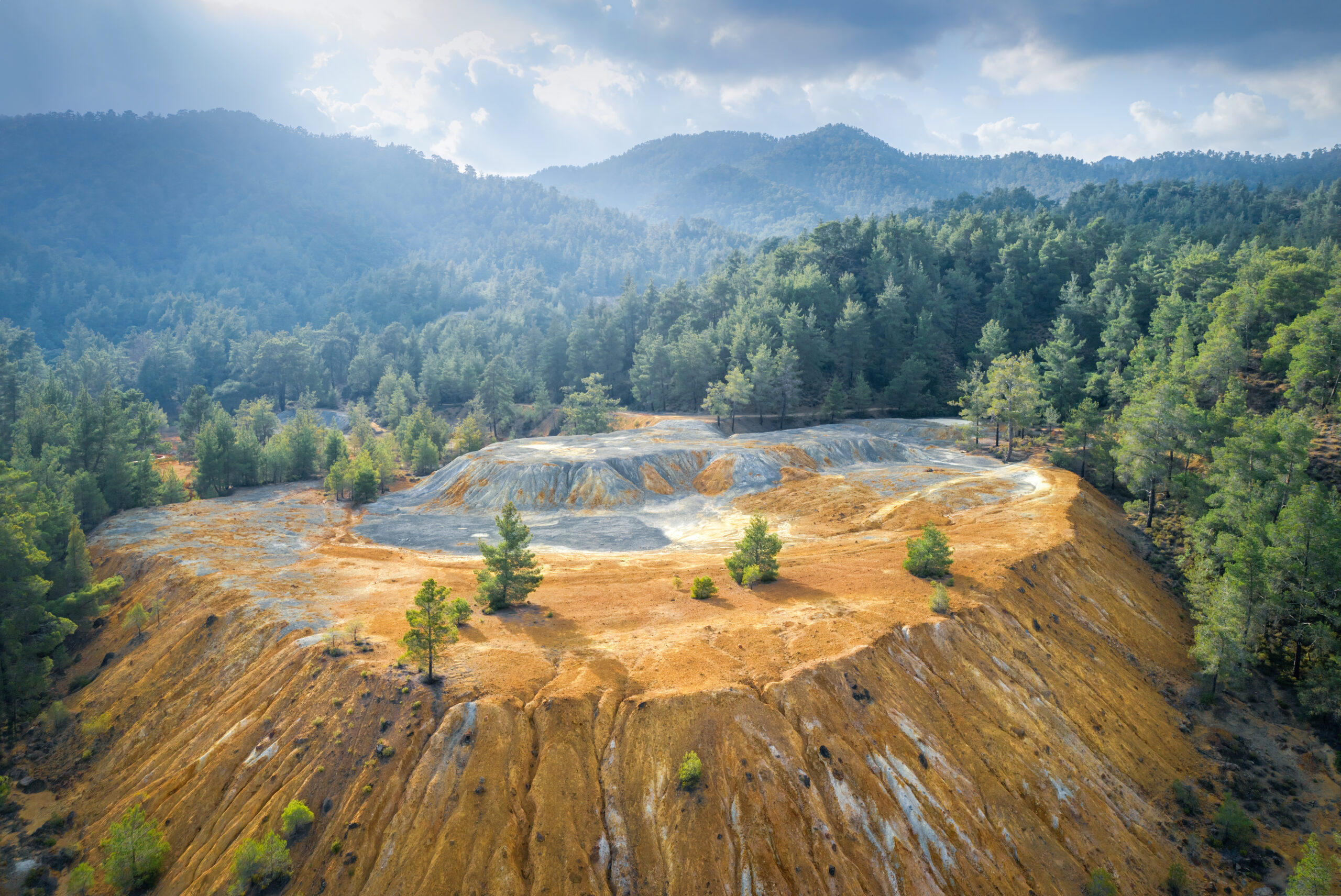
Una solución comunitaria y medioambiental


Características


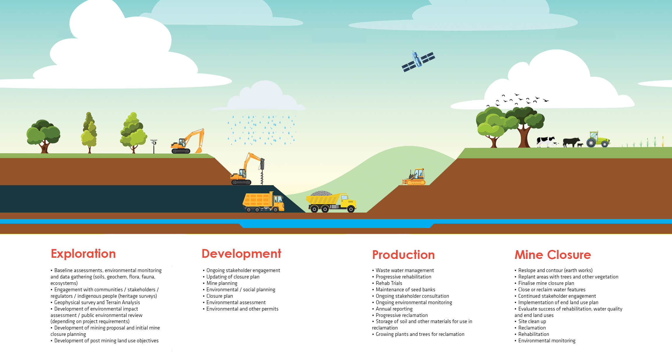
Cubriendo el espectro de la rehabilitación y el cierre de principio a fin
Exploración
Desarrollo
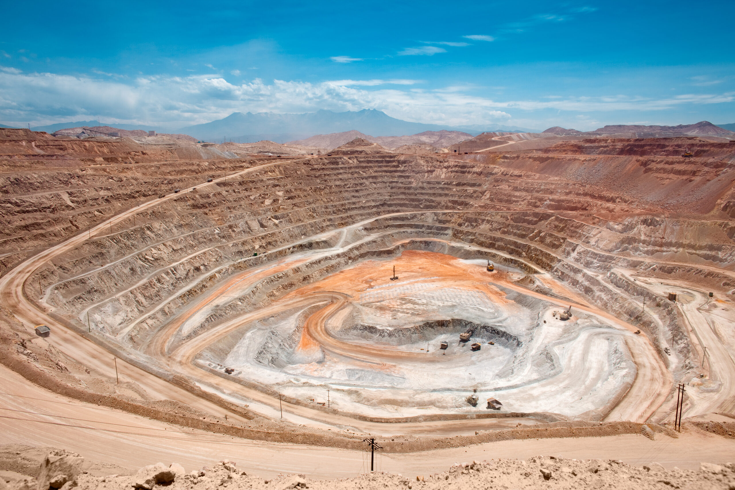
Producción
Cierre
Amplíe su capacidad con nuestras soluciones integradas

El K2fly Plataforma
Actualizaciones periódicas
Constantemente añadimos nuevas funcionalidades a nuestra solución que se transmiten a su empresa para que se beneficie
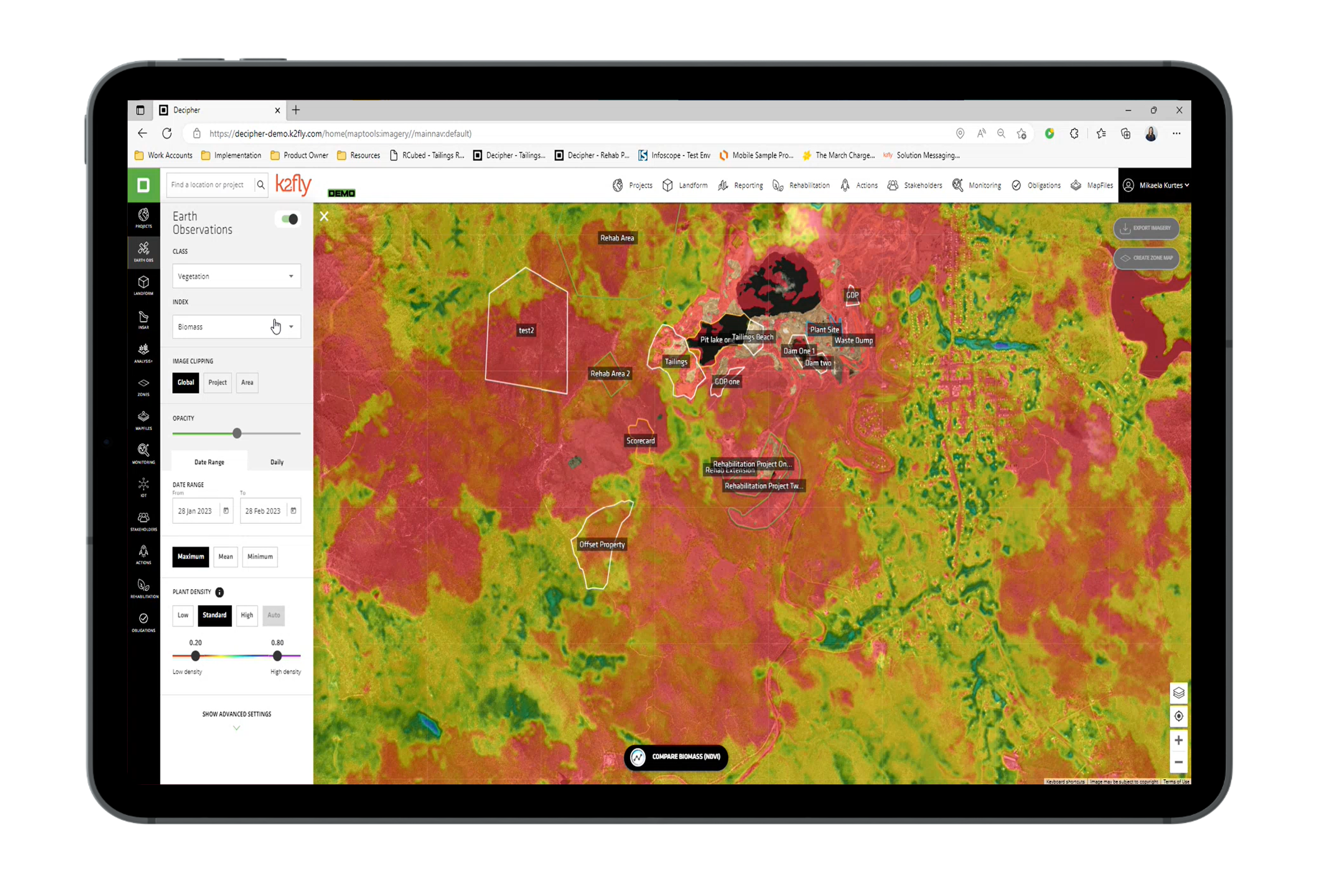
Acceso a la nube
Acceda de forma segura a los datos desde cualquier lugar del mundo, en casi cualquier dispositivo para reducir los desplazamientos y en tiempos como COVID
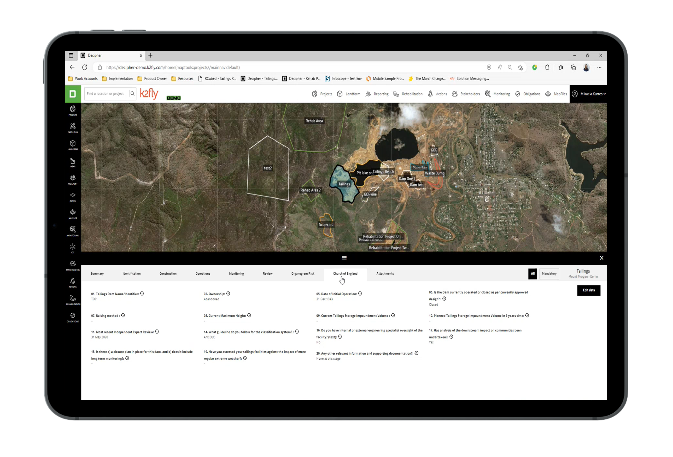
Integración de terceros
Nos integramos con sus sistemas y APIs existentes para eliminar la interrupción del negocio y aumentar la eficiencia operativa
Asociaciones sólidas
Nos asociamos con organizaciones líderes del sector, como SAP, ESRI y CrC-TIME, para mejorar los resultados y ofrecer las mejores prácticas
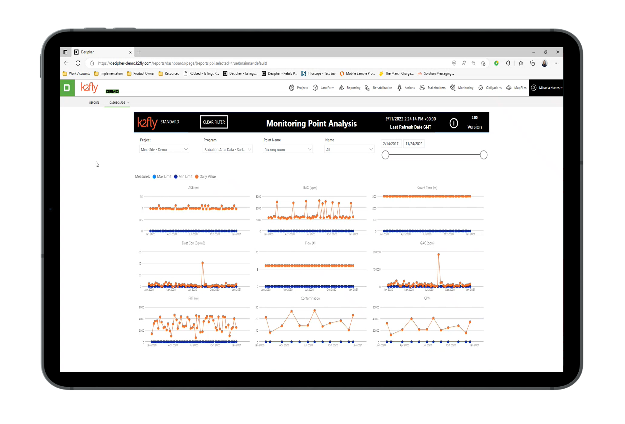
Informes de fácil acceso
Nuestras soluciones incluyen herramientas para la elaboración de informes y cuadros de mando, pero también permiten la elaboración de informes y la exportación de datos por parte de terceros.
Gestión de usuarios
Controle de forma segura el acceso de los empleados, auditores y contratistas para que puedan ver los datos y la funcionalidad que necesitan